Background
The increasing frequency and intensity of extreme weather events have led many municipalities to reassess how they monitor and respond to flood risk. While national monitoring systems play a critical role, flood impacts are often highly localized, particularly in urban and semi‑urban environments. Municipal authorities are therefore seeking localized flood monitoring and alert systems that provide timely, actionable data at the community level.
Challenge
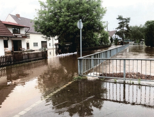
Communities across Germany have experienced increased flooding caused by intense rainfall, surface runoff, and overwhelmed sewer systems. In municipalities such as Kötz and Bad Homburg, flood risk is amplified by local geography, including river confluences and dense infrastructure. Limited staffing and resources made frequent on‑site inspections difficult, creating the need for reliable, remotely managed monitoring systems capable of issuing timely flood alerts.
Solution
In response, several municipalities partnered with OTT HydroMet to implement localized flood monitoring networks using cost‑effective, low‑maintenance sensor technology.
Municipality of Kötz, Bavaria
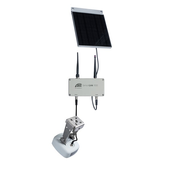
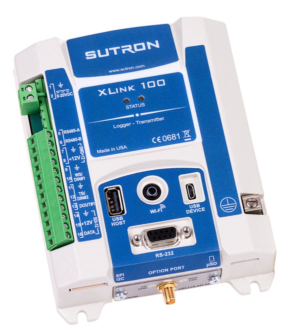
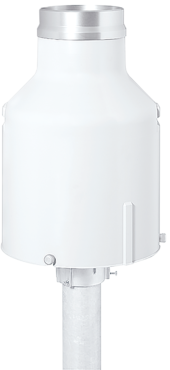
In early 2024, the municipality of Kötz installed three monitoring stations at flood‑prone locations near the Kötz creek and the Günz river. Two stations measure river water level using OTT ecoLog 1000 devices installed in stilling wells secured to the riverbank. The third station measures both rainfall and water level using a solar‑powered XLink 100 datalogger connected to an OTT Pluvio² L weighing rain gauge and an OTT PLS water‑level sensor.
All stations transmit data via cellular networks to a cloud‑based server. Municipal staff access and manage the system through Hydras 3 Net software, which is configured to issue alerts to emergency services when predefined thresholds are exceeded.
Bad Homburg, Friedrichsdorf and Wehrheim
To address shared flood risks, the municipalities of Bad Homburg, Friedrichsdorf and Wehrheim established an inter‑municipal early warning program. In 2024, five monitoring stations were installed, each equipped with an OTT netDL 500 datalogger and cellular modem. The stations measure precipitation and water level using OTT Pluvio² S weighing rain gauges and bridge‑mounted OTT RLS radar level sensors.
Weather parameters such as wind, temperature, pressure, humidity and precipitation type are measured at selected locations using all‑in‑one weather sensors. Data from all stations is transmitted wirelessly to the cloud and managed centrally via Hydras 3 Net software. Real‑time data visualization and alerts are also made available to citizens through web portals.
Results
The monitoring networks enable municipalities to receive reliable, real‑time flood and weather data and to issue automated alerts when flood risk increases. This improves response time and provides critical decision support for emergency services and municipal authorities.
In Kötz, the system successfully issued timely alerts during heavy rainfall events, allowing mitigation measures such as sandbag deployment, road closures and evacuations to be implemented. Different water‑level thresholds trigger different alarms, ensuring that responses are appropriate to the severity of the situation. Alerts are transmitted automatically via SMS to municipal authorities and local decision‑makers.
Beyond emergency response, the collected data supports long‑term infrastructure planning and climate‑resilience efforts.
Conclusion
These localized flood monitoring networks demonstrate how municipalities can strengthen flood resilience when large‑scale warning systems lack the resolution required for local decision‑making. By combining digital environmental monitoring, smart sensors and centralized data management, local authorities gain timely insights that protect residents, infrastructure and emergency responders.