Challenge
After a wildfire in the nearby mountains increased the likelihood of water run‑off into the town of La Veta, Colorado, it became necessary to know when a flood event was approaching so citizens would have enough time to evacuate.
In 2018, the Spring Creek wildfire spread across 108,045 acres in Southern Colorado and became the third‑largest wildfire in Colorado history. Approximately 65,000 acres of the burned area became hydrophobic, meaning the soil rejected water rather than absorbing it.
La Veta lies only five miles downstream from this burned area. The terrain allows water to flow downhill rapidly, often building force and speed or forming walls of water. As a result, runoff intensity and flood risk increased dramatically.
Before the wildfire, La Veta was estimated to experience a major flood event once every 100 years. After the fire, this risk was recalculated to occur once every two years.
Given this risk, it became critical to know when flood events were approaching to provide enough time for safe evacuation. Mayor Doug Brgoch calculated that with the existing system, residents would have only 32–45 minutes to evacuate, while past experience showed it could take up to two hours to move people to safety.
“Just a few more minutes could save many lives. It became all the more important to see how we could gain just an extra five minutes.”
– Doug Brgoch, Mayor of La Veta
Collecting Flood Risk Data
As summer approached — the season that typically brings intense monsoons to Southern Colorado — Mayor Brgoch acted quickly. He partnered with the Colorado Division of Water Resources, which has more than 100 years of experience managing water resources and oversees more than 600 surface‑water monitoring sites across the state.
The objective was to establish a network of monitoring stations capable of identifying when tributary streams reached flood stage and to determine appropriate threshold levels that would trigger alerts.
Financing for the project was administered by the Huerfano County Water Conservancy District and funded through contributions from:
- Huerfano County Water Conservancy District
- Colorado Division of Water Resources
- Colorado Department of Homeland Security and Emergency Management
- Huerfano County
- Colorado Water Conservation Board
Solution
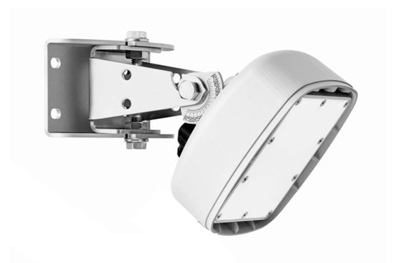
Seven monitoring stations equipped with SUTRON and OTT HydroMet technology were installed within a 13‑mile radius of La Veta to measure:
- Precipitation
- Water level
- Water surface velocity
The stations were delivered as pre‑wired and pre‑mounted enclosures and installed in the field with minimal on‑site configuration.
Each station includes:
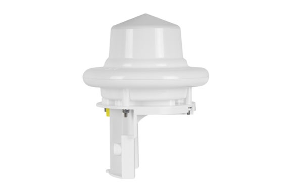
- 1 OTT Radar Level Sensor (RLS)
- 1 OTT Surface Velocity Radar (SVR 100)
- 1 Lufft WS100 Radar Precipitation Sensor / Smart Disdrometer
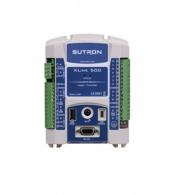
- 1 SUTRON XLink 500 data transmitter
- 1 solar panel housed in a NEMA‑4 enclosure
Data from six of the seven stations is compiled into a watershed matrix, allowing officials to evaluate how water from multiple tributaries interacts during rain events. Thresholds can be evaluated collectively — for example, a single station exceeding limits may not cause alarm, while simultaneous rises across several stations indicate serious flood risk.
Data Transmission and Monitoring
Initially, there was concern that data might not reach stakeholders quickly enough to be actionable. While traditional surface‑water systems rely on GOES satellite transmission with hourly updates, the team selected Iridium® satellite telemetry, allowing data updates every three minutes when water levels exceed thresholds.
This approach is particularly effective in the remote La Veta region, where cellular coverage is limited. Two‑way Iridium communication also enables remote adjustment of alarm thresholds as emergency managers refine their response strategies.
All stations are connected to Hydromet Cloud, a data‑management platform that provides:
- Real‑time public visibility of station data
- Customizable alarm thresholds
- Two‑way remote system configuration
- Mobile access for rapid field decisions
“The goal of this system is to provide timely information to emergency managers without placing them in harm’s way… It’s like having eyes in the field.”
— Matt Hardesty, Colorado Division of Water Resources
Results and Impact
Since installation, no full evacuation has been required. With each storm event, the system continues to improve as thresholds are refined and the town gains a better understanding of how much rainfall the watershed can handle before reaching emergency conditions.
For a small community like La Veta, remote monitoring has been critical. Staff no longer need to manually inspect field sites, allowing them to focus on response efforts when it matters most.
Mayor Brgoch emphasized the value of the system:
“These instruments are key because they give us that extra element of confidence when making important decisions.”
The town also highlighted the reliability, customization, and on‑site support provided by OTT HydroMet, particularly during installation and commissioning.
Technologies Used
- OTT Radar Level Sensor (RLS) – non‑contact level monitoring
- OTT Surface Velocity Radar (SVR 100) – non‑contact surface flow measurement
- Lufft WS100 Smart Disdrometer – precipitation measurement
- SUTRON XLink 500 – multi‑sensor data logging and telemetry (Iridium®)
- SUTRON Solar Panels
- SUTRON NEMA‑4 Enclosures
.jpg)