Satellite telemetry supports flood protection in Scotland
A resilient method for monitoring water quality and nitrate levels in the harsh aquatic environment of the Mississippi River, in section 16, was required by the University of Iowa -IIHR.
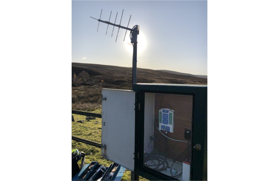
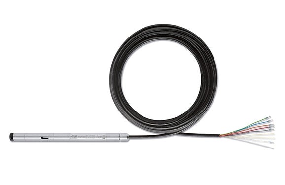
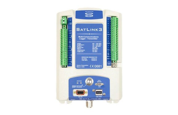
SEPA's (Scottish Environment Protection Agency) flood forecasting and warning relies on a network of water level and precipitation monitors, some of which are located in remote areas of catchments, where the communications infrastructure can be less reliable. The SUTRON SatLink3, a combined datalogger and satellite transmitter, was therefore trialled at a site in Boat of Garten, near Aviemore. The logger is SDI-12 compatible, and an OTT PLS sensor was used to monitor water levels and temperature, in addition to a rain gauge and an air temperature sensor.
Scotland’s water resources are renowned worldwide and play a vital role in tourism as well as the production and reputation of some of the country’s most important exports. To protect these resources and support effective water management, the Scottish Environment Protection Agency (SEPA) closely monitors rivers and catchments, including tracking long‑term trends such as the impacts of climate change. A key part of this activity is Floodline, a free 24/7 flood forecasting and warning service delivered via telephone and online platforms, providing advance notice of flooding alongside practical advice to help communities prepare. Floodline issues regional flood alerts to raise early awareness across wide areas, as well as targeted flood warnings for specific locations where local communities and emergency responders may be affected.
SEPA’s flood forecasting and warning capability depends on a network of water level and precipitation monitoring stations, many of which are located in remote catchments where communications infrastructure can be unreliable. To address this challenge, the SUTRON SatLink3 – combining data logging with satellite communication – was trialed at a site in Boat of Garten near Aviemore. The system is SDI‑12 compatible and was deployed with an OTT PLS water level and temperature sensor, alongside a raingauge and air temperature sensor, enabling reliable data collection and transmission from a challenging location critical to flood warning operations.
Share
Blog Team
Observing the elements is key to better understanding our planet. This blog tells the manifold stories of experts working in environmental monitoring with help of our sensors and solutions.